Two Gravel Rides Out of a Pinery Campsite: Rock Glen Falls and the Park Loop
Most cycling trip reports are about carrying your camp on the bike. This one isn’t. We drove to Pinery Provincial Park, booked a site for three nights, and rode out of it — which is what most people with a bike on the roof rack are actually doing, and which turns out to have a real advantage the bikepacking version doesn’t: when the weather goes wrong, you are twenty minutes from a dry tent instead of forty kilometres from anywhere.
That mattered on this trip, because the weather did go wrong.
Quick answer: Pinery makes a good cycling basecamp. Inside the park there’s a 14 km paved bike trail with rentals, now connected to the former Burley access road, closed to cars and converted to a cycling route — the backbone of a 22 km loop that never leaves the park, about two-thirds paved and a little over an hour’s riding. The standout is the 63 km loop inland to Rock Glen Falls at Arkona, a waterfall over exposed Devonian shale with one of southern Ontario’s better fossil beds at its base. Flat by the lake, gently rolling inland. A gravel bike is the right tool; a road bike would mostly work.
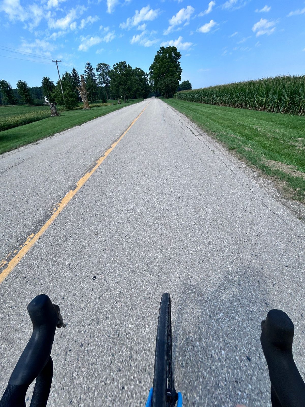
The two rides
| Ride | Distance | Climbing and time | Route | Track |
|---|---|---|---|---|
| Pinery → Rock Glen Falls (Arkona) → Pinery | 63 km (58.3 km on the published line) | +492 m, 2:48 moving, 23 km/h average (Garmin; the drawn line says +376 m) | A loop, not an out-and-back — gravel and quiet paved concession roads out via Bog Line and Arkona Road, back via Sylvan Road and River Road | GPX |
| Around the park | 22 km (21.3 km on the published line) | +165 m, 1:07 moving, 19.6 km/h average (Garmin; the drawn line says +92 m) | Loop, entirely inside the park: the old Burley road, ski-trail singletrack, the savanna trail and the park road. About two-thirds paved. | GPX |
| Pinery → Port Franks | abandoned midway — heavy rain | — | Shoreline, northwest toward the Ausable | — |
We had three nights, arriving Sunday 30 August and leaving Wednesday 2 September. The shakeout ride to Port Franks was the Sunday, in the storm. Rock Glen was the Tuesday. The park loop was Wednesday morning, before we packed the car — which is a small argument for basecamp cycling all by itself: you can still get 22 km in on the day you leave.
The two could hardly be less alike — one crosses 63 km of open farmland, the other never leaves the trees — and yet they begin identically. Both roll out of the site onto the old Burley road, turn right into the ski trail at about 3 km, and reach the same unmarked junction a few hundred metres later. Right goes to Rock Glen, left keeps you in the park. Everything that makes them different happens after that one turn.
One note on those tracks: both are drawn lines, not recorded rides, so neither carries timestamps and all the times above come off the Garmin. The park loop line is faithful — 21.3 km against 22 on the computer. The Rock Glen line is looser at 58.3 km against 63, and takes a slightly different way home than the turn-by-turn below. Follow the written route for the route and the Garmin for the numbers; the file is a shape to load into a head unit, not a survey.
Ride 1: Rock Glen Falls, 63 km
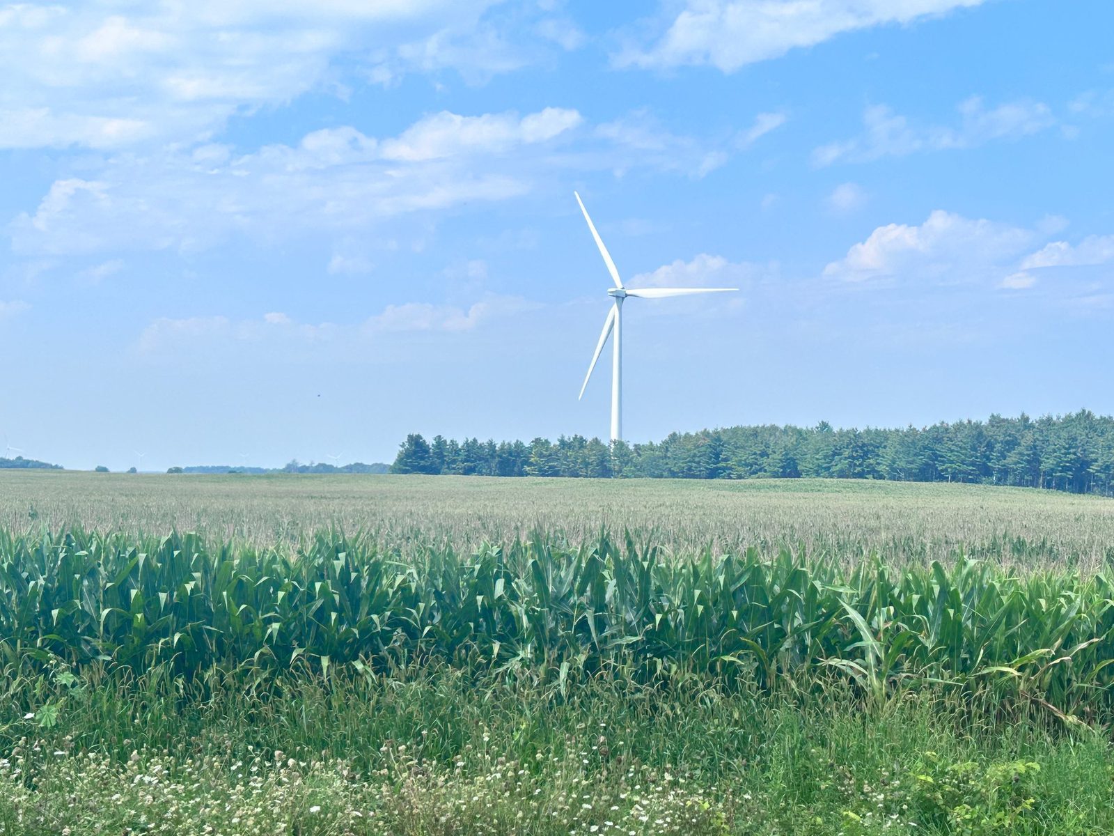
This is the one to do if you only do one, and it is nothing like riding inside the park. Pinery is enclosed — oak, pine, dunes, the channel, all of it at arm’s length. Ten kilometres past the gate the trees stop and it is corn to the horizon with wind turbines standing over all of it. One of the rarest habitats in Ontario to one of the most thoroughly worked landscapes in the province, in under half an hour.
The turbines are the Jericho Wind Energy Centre — 92 turbines across Lambton and Middlesex counties, 149 MW, running since November 2014. What you notice from a bike is that there is no wind farm to arrive at: they stand in the farmers' fields themselves, corn grown to the base of each one, a short gravel track off the concession road, no fence or compound. You ride through them for the better part of an hour, watching the same turbine slowly get closer because the roads refuse to bend. Some people find that bleak. We liked it.
You also, quietly, climb — 492 m over 63 km, in dozens of rises you barely register. The one that counts is at the far end: the park sits at about 179 m and the ground above Arkona around 250 m, and most of that 70 m arrives in the last few kilometres as you come off the flats onto the higher ground the Ausable has cut its gorge into. The way home gives it back, which is why the day averages 23 km/h.
The loop, turn by turn
Sixty-three kilometres as a loop — out one way, home another, so you never ride the same road twice — in 2:48 of moving time. Distances from the campsite in Burley: roughly 24 km out to Rock Glen, and a longer way back.
Out on the old Burley road, then at km 3 right into the ski trail, and right at the unmarked junction towards Highway 21 — the fork described above.
If you’re on a pure road bike, skip the singletrack entirely: ride to the park gate and turn right onto Highway 21 southbound. It adds about 6 km and puts you on a highway shoulder, but it gets you to the same place on 25 mm tyres.
At km 5, after crossing the Ausable, turn right onto hard-packed gravel and start the corn. Then left, another left onto Bog Line, and right onto Gordon Road.
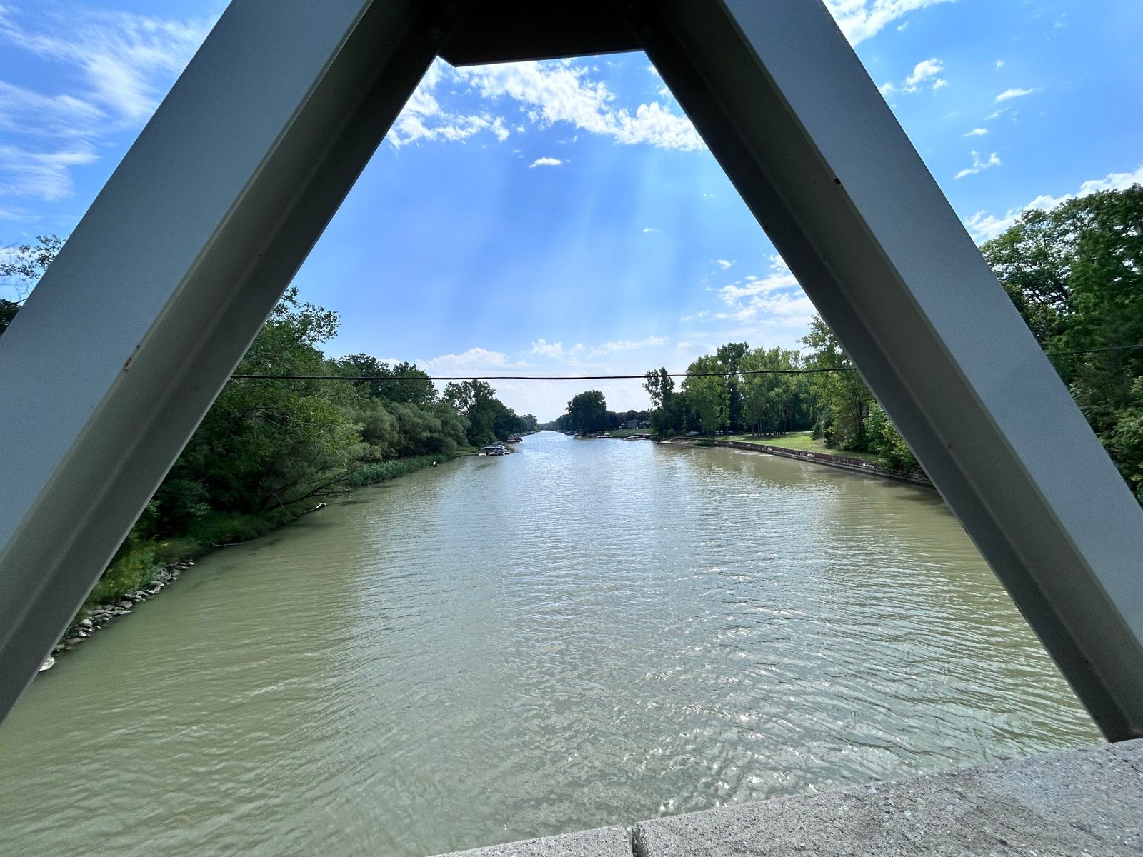
Km 12 is Shale Ridge, the estate winery and cidery at 9090 Widder Road — a genuinely odd thing to find out here, and a reasonable turnaround in its own right if you want a 24 km ride instead of a 63 km one.
Continue on Widder Road until it joins Arkona Road, which is paved and runs dead straight south for 7 km. Turn left, east, onto Rock Glen Road.
Km 24: Rock Glen. Lock the bike at the gate or walk it in, and pay the $4.25. Skip the museum, but fill your bottles near it — the only reliable water on the route.
Then the long way home. East from the falls, then left — north — onto Sylvan Road, which is narrow, paved and almost traffic-free. There are gravel options either side if you want to make it harder; we ran straight north for 13 km to Avenue Drive, which parallels the busy Parkhill Drive without being it. Then north again onto the hard gravel of River Road, following the river and looping out through the corn back to Highway 21. Cross 21 carefully — this is the one genuinely unpleasant moment of the day — and pick up the ski trail back into Burley.
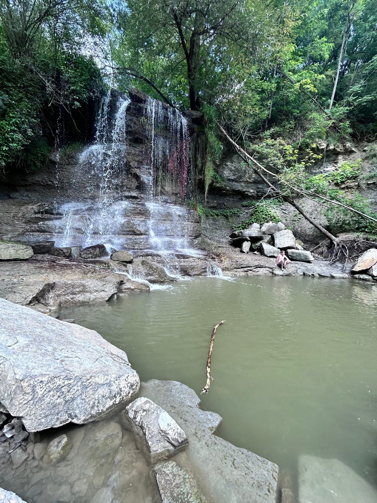
Rock Glen Conservation Area is at 8680 Rock Glen Road, on the edge of Arkona. A tributary drops over an exposed face of Devonian shale into a plunge pool, and the creek bed below is one of the better fossil sites in southern Ontario — rock more than 350 million years old, weathering out brachiopods, horn corals and crinoid stems. Walk down, and put your feet in; stepping into the fall after 24 km of corn is the correct decision.
Two things to know before riding 24 km to get there. It is a conservation area, not somewhere you wander into: $4.25 per person, so carry a card or coins in your jersey, and you may take one fossil home, only one — digging or using tools is prohibited. And it is open early May to the end of October, sunrise to sunset, a wider window than the park’s own camping season, which makes this a good shoulder-season ride.
The corn and the turbines are the constant whichever roads you pick, but the return is genuinely a different ride: Sylvan Road and River Road are narrower, quieter and prettier than the run out on Arkona Road, and they are the reason to loop rather than turn around.
Ride 2: around the park, 22 km
We rode this on the last morning, between breakfast and striking the tent — which is the version most people will do. It works because the in-park riding got noticeably better this year, for a reason that has a name.
The direct access road to Burley campground has been removed, its entrance building is gone, and the roadbed has been converted to a cycling route. Cars now reach Burley through the Dunes campground instead — a mild inconvenience if you’re driving in, a straightforward gift if you’re on a bike. We saw this ourselves on a stay ending 2 September 2026, and neither the park page nor the camping page describes it, so don’t expect a current park map to show it.
What the park hasn’t posted, the Environmental Registry has. Notice 026-0675, an amendment to Pinery’s management plan posted 3 July 2026, proposes an “addition to the nature reserve, natural environment zone and reduction in development zone to support Burley Campground restoration” — under a name the plan uses directly: Rewilding Burley, listed in its priorities as “restoration and recreation development.” A campground road becoming a bike route is what those words look like on the ground.
It is not a small program. Around 91 campsites have already gone and up to 200 more are proposed, to protect the oak savanna and the dunes, and Burley appears to have absorbed most of it: the management plan document describes “Burley, with 302 campsites”; the reservation system today offers 195. Fewer sites, more restored ground, and — as a side effect nobody advertises — better riding.
The loop, turn by turn
Twenty-two kilometres, 1:07 of moving time, 19.6 km/h average, about two-thirds of it paved — and not one metre of it outside the park gate. Distances below are from the campsite in Burley.
Start on the old Burley road, which sets the tone: wide double track, the asphalt gone entirely, gravel over the roadbed and soft in places — enough that a narrow tyre would be working. You pass where the old Burley gate was; the building is gone and the ground is being given back.
Past the bridge over the Old Ausable Channel, then at about 3 km turn right onto the ski trail — the junction that decides your ride. Left crosses into Riverside. Straight on is the option if you would rather not ride singletrack. Right is the interesting way.
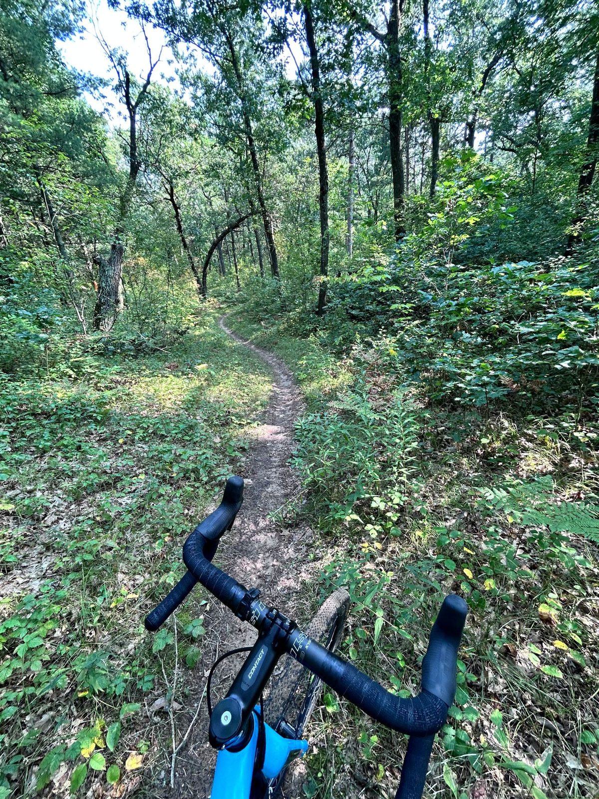
The ski trail is narrow and twists through oak-pine forest; at an unmarked junction at about 3.75 km, turn left, then roughly 3 km of singletrack north until you cross the park road at about 7.5 km.
Pick up the savanna trail west. Where it meets the narrow park road — shared with cars, so ride it as a road — that road carries you the rest of the way round, past several trailheads if you want to stop and walk one.
Two places worth stopping: the bridge over the channel at about 11.5 km, for the reflection, and the beach at P1 at about 13 km at the north end. From P1 it’s either the bike trail back through the savanna or the road; we were in a hurry and took the road, through Dunes to the site.
Speeds are low and you are never far from your site, which makes the paved version — skipping the singletrack at the 3 km junction — the answer if you have kids or less confident riders along. It is also a sensible recovery spin: 165 m over 22 km is about seven metres a kilometre, which is to say you won’t notice it.
Ride 3, which didn’t happen
Sunday, the day we drove in, was supposed to open with a shakeout ride northwest along the shoreline to Port Franks, at the mouth of the Ausable River. The storm that defined the whole trip arrived instead, and I turned around halfway.
That’s the case for basecamp cycling in one sentence. On a bikepacking trip, abandoning a day means abandoning the plan — you still have to get somewhere and the tent is on your back. Here it meant riding twenty minutes back to a site with a tarp over the picnic table, drying off, and going again the next morning. The rides you can bail out of are the rides you’ll actually take in changeable weather.
What the booking site can’t tell you about cycling
Of the 100 Ontario Parks frontcountry camping parks in our data, 98 list “cycling” as an activity. Ticking that box on a booking site removes two parks from your options. It doesn’t distinguish between a park with 14 km of paved trail and one where “cycling” means you may ride the campground road to the comfort station. (The mountain_biking tag is at least discriminating — 29 of the 100 — but that’s a different sport.)
What actually decides whether a park works as a cycling basecamp is none of it:
- Is there anything to ride outside the gate? Pinery’s real asset is the concession grid behind Lambton Shores, which belongs to no park and appears in no park dataset.
- Can you leave without riding a highway shoulder? This is the one that quietly rules parks out — plenty are hung off a single busy road.
- Is there a destination at a sensible distance? Sixty-three kilometres to a waterfall and a fossil bed is a ride. Sixty-three to a turnaround signpost is an errand.
- Is there a short option for a bad-weather day, or for slower riders?
None of those four are in any booking system, which is why we ride the routes and write them down.
Practical notes
Bike. A gravel bike suits the mix — paved concession roads with gravel stretches, the park trail, the soft Burley roadbed and a few kilometres of real singletrack. A road bike handles the 63 km and the paved version of the park loop, but not the ski trail; a mountain bike will be slow on the 63 km.
Water and money. Fill up in the park and again at Rock Glen — the tap by the museum is the only reliable one on the route, with Shale Ridge at km 12 as the other option if it’s open. Rock Glen charges $4.25 a person at the gate, easy to forget when the wallet is in the tent.
Where you sleep. Burley is unserviced, quietest, and now sits at the end of a car-free road; Riverside is largely electrical; Dunes is closest to the beach. The full breakdown — 973 sites across 11 booking areas with privacy and noise data by area — is in the companion post: Three nights in the Pinery, bookended by storms.
Rentals and season. Pinery rents bikes, plus canoes, kayaks and paddleboards for the Old Ausable Channel. We rode at the end of August; spring and September are better inland — less heat, fewer bugs, and Rock Glen stays open to the end of October. In winter the park carries 38 km of groomed ski trails instead.
How we know all this
Campaid is a booking assistant for Canadian camping trips. It checks live availability across Ontario Parks, Parks Canada, Sépaq and more — per night rather than as a single sold-out yes/no — and factors in what the booking page never tells you: fire bans, road and rail noise, how exposed a site is, weather from Environment and Climate Change Canada, and drive time from where you live.
Cycling is the clearest case of the gap. The booking systems hold a tag that 98% of parks satisfy; what a cyclist needs to know is what’s outside the gate, and nobody holds that at all. So we go and ride it. If you know a better route out of Pinery than ours, we’d like to hear it.
Frequently asked questions
Can you cycle at Pinery Provincial Park? Yes. There’s a 14 km paved bike trail with rentals, now connected to the former Burley access road, closed to cars and converted to a cycling route. Chained together with the ski trail, the savanna trail and the park road that makes a 22 km loop that never leaves the park — about two-thirds paved, a little over an hour. There’s a paved-only version if you’d rather skip the singletrack.
How far is Rock Glen Falls from Pinery by bike? About 24 km out and a longer way back — 63 km all in as a loop, 2:48 moving at 23 km/h, 492 m of ascent. Out via Bog Line, Gordon Road, Widder Road and Arkona Road; back via Sylvan Road, Avenue Drive and River Road. Most of it crosses open corn country under the 92 turbines of the Jericho Wind Energy Centre.
What’s at Rock Glen Conservation Area? A waterfall over an exposed Devonian shale face at Arkona, with one of southern Ontario’s better fossil beds at its base — rock more than 350 million years old, weathering brachiopods, horn corals and crinoid stems onto the creek bed. Admission $4.25 per person; you may take one fossil home, and digging or using tools is prohibited.
Is there singletrack at Pinery? Yes — the park loop uses about 3 km of it. Turn right at roughly the 3 km mark onto the ski trail, take the unmarked left at 3.75 km, and it crosses the park road at 7.5 km: narrow and twisty through oak-pine forest. Carry straight on at the 3 km junction instead and the loop stays on wider surfaces. Not all Pinery trails are open to bikes, so check before riding one that isn’t on the route.
Do I need a gravel bike? No, but it’s the best fit. The routes mix quiet pavement with gravel sections. A road bike will manage most of it; a mountain bike will make the 63 km slower than it needs to be.
How do I get to Burley campground now that the road is closed? Through the Dunes campground. The direct road and its entrance building have been removed and the roadbed converted to a cycling route — we saw this on a stay ending 2 September 2026, and the park’s website doesn’t yet describe it. It fits the “Rewilding Burley” restoration in Environmental Registry notice 026-0675.
What is Rewilding Burley? A named restoration program in the proposed amendment to Pinery’s management plan (ERO 026-0675, posted 3 July 2026): part of the Burley area is rezoned from development to nature reserve, listed under implementation priorities as “restoration and recreation development.” Around 91 campsites have already gone park-wide, with up to 200 more proposed, to protect the oak savanna and dunes.
Which days did you ride? Three nights, Sunday 30 August to Wednesday 2 September 2026. The Port Franks shakeout was abandoned in the rain on the Sunday, Rock Glen was the Tuesday, and the park loop was Wednesday morning before we packed up.
Is Pinery a good cycling basecamp for kids or beginners? Yes, for the in-park riding specifically — the bike trail and the now-car-free Burley road are low-speed, low-traffic and never far from your site. The 63 km inland ride is a different proposition.
Campaid checks live availability across Ontario Parks, Parks Canada, Sépaq and more — per night, with cancellations, noise, privacy and fire bans factored in. Try it free.