Five Days Canoeing the French River Delta: A 55 km Loop from Hartley Bay
Most of what we write here comes out of data analytics. This one comes out of first hand canoeing plus data.
In August we paddled a five-day loop through the French River Delta — the boat-access-only maze of channels and pink granite where the river finally breaks apart and empties into Georgian Bay, west of Highway 400/69. No road reaches it. We came back with five GPS tracks, a set of campsite notes, and one lesson about food storage that cost us a bag of groceries last year.
Quick answer: The delta loop out of Hartley Bay Marina is about 55 km, and it splits cleanly into five days of 7 to 14 km — short enough that you're off the water by mid-afternoon every day. It needs no whitewater skill if you take the eastern channel through the Five Finger Rapids: two easy swifts and one short, steep 160 m portage around the Lily Chutes. Sites are numbered and reserved individually up to five months ahead, and in March there was still plenty of choice for an August trip. Sites are basic and spartan — you need to be completely self-sufficient, including a hard-sided food barrel.
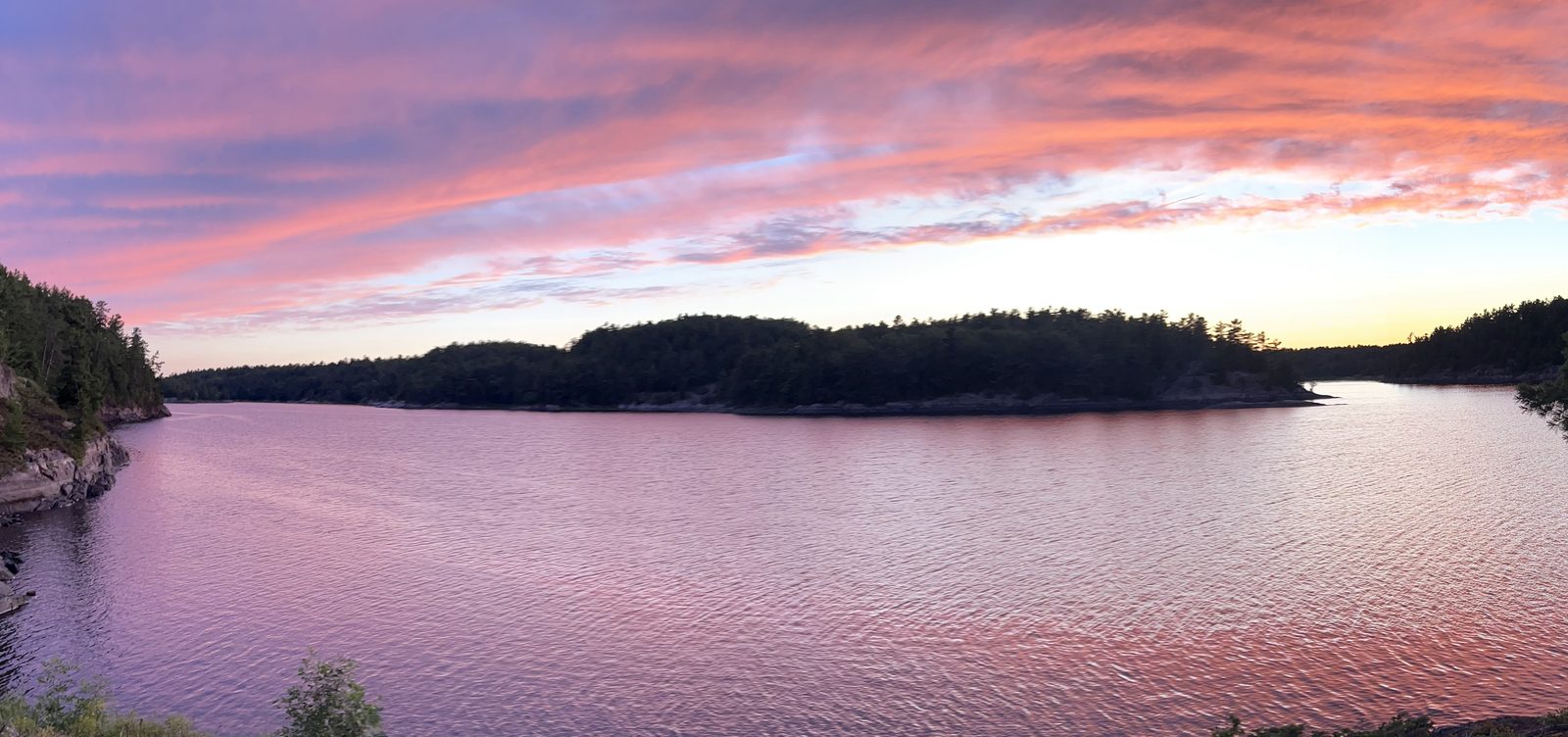
The route, day by day
| Day | Distance | From → to | What's on it | Track |
|---|---|---|---|---|
| 1 | 14.0 km | Hartley Bay → site 687 | Open water, big tailwind day. Lunch at site 661. | GPX |
| 2 | 10.9 km | 687 → site 812 | Five Finger Rapids, two swifts, 160 m portage at the Lily Chutes. | GPX |
| 3 | 7.4 km | 812 → site 733 (Sabine Island) | Canal maze, two liftovers, then an hour on the edge of Georgian Bay. | GPX |
| 4 | 8.5 km | 733 → site 647 | Bass Creek and Bass Lake, two short portages, back to the main river. Shorter option below. | GPX |
| 5 | 14.3 km | 647 → Hartley Bay | The Canoe Channel, heavy motorboat traffic near Ox Bay. | GPX |
| 55.1 km | all 5 |
Those distances are measured off our own GPS tracks, not estimated. For comparison, the same circuit is published elsewhere as the "West Channel Loop" at 52 km over 3–5 days — so if you'd rather do it in four days, or three, the arithmetic works; you just lose the afternoons.
If you want to redraw the loop around different sites, gpx.studio is the easiest way to do it: draw the route on the map, read the distance off, and split it into days you're actually happy to paddle. That's how we sanity-checked ours before booking, and it's the difference between "about 10 km, probably" and knowing you'll be at camp by two.
For on-the-water navigation, take paper. Cell service is unreliable out here and the delta is a genuine maze — channels that look identical, islands that aren't where you assumed. Maps by Jeff publishes the French River as two double-sided sheets; the one you want for this loop is West French River, Highway 69 out to Georgian Bay. It's waterproof and tear-resistant, marks portages with elevation profiles, and labels distances and estimated times per stretch — and each purchase (US$25 at the time of writing) also comes with the digital versions, including Avenza and Garmin files, so it doubles as your phone backup.
Day one was the fastest: 14 km in 2 hours 43 minutes, about 5 km/h, on a strong tailwind. Day two's 11 km took two and a half hours including the portage. Day five's 14.3 km took four hours against ordinary traffic. Nothing about this loop is a grind.
A shorter day four. There's an alternative that cuts the fourth day roughly in half: instead of swinging west into Bass Creek and Bass Lake, paddle straight north from Sabine Island up to the Dalles rapids and take the 300 m portage through to site 647. That's about 5 km instead of 8.5, with one longer carry in place of two short ones. Worth knowing if the morning is windy, if you got a late start off the bay, or if you'd simply rather spend the afternoon swimming at 647 than paddling toward it.
Campsite notes, with numbers
This is the part the reservation page can't tell you. Sites in the delta are booked individually by number, so which number you pick genuinely matters.
| Site | Verdict | Why |
|---|---|---|
| 687 | Good | Ripe blueberries, steep exposed-granite scramble up to the tent pads. Strong legs required, not just strong arms. |
| 661 | Good, worth booking | We only stopped for lunch, but it would make a fine night. Same blueberry-and-granite character as 687. |
| 692 | Excellent | Sandy beach, good rocks, sits just above the rapids. Ideal for either a night or a lunch break before you commit to the Five Fingers. |
| 812 | Good site, noisy neighbours | A beautiful exposed slab of granite with trees behind — and about ten large yachts anchored in the adjoining bay off Georgian Bay. |
| 813 | Book this instead | Same area, away from the yacht anchorage. This is the solitude pick. |
| 801 | Excellent for lunch | On the Georgian Bay shoreline. Fine for a night too, if no storms are forecast. |
| 733 | Excellent | Sabine Island. |
| 647 | Excellent | Near the Dalles rapids: great scenery, a good swimming spot, three fire pits, and flat pads for two or three tents. One caveat below. |
The caveat at 647: a yellow sign marking recent bear activity in the area. We saw nothing, and it stayed a comfortable site, but go in knowing.
The Five Finger Rapids without whitewater skills
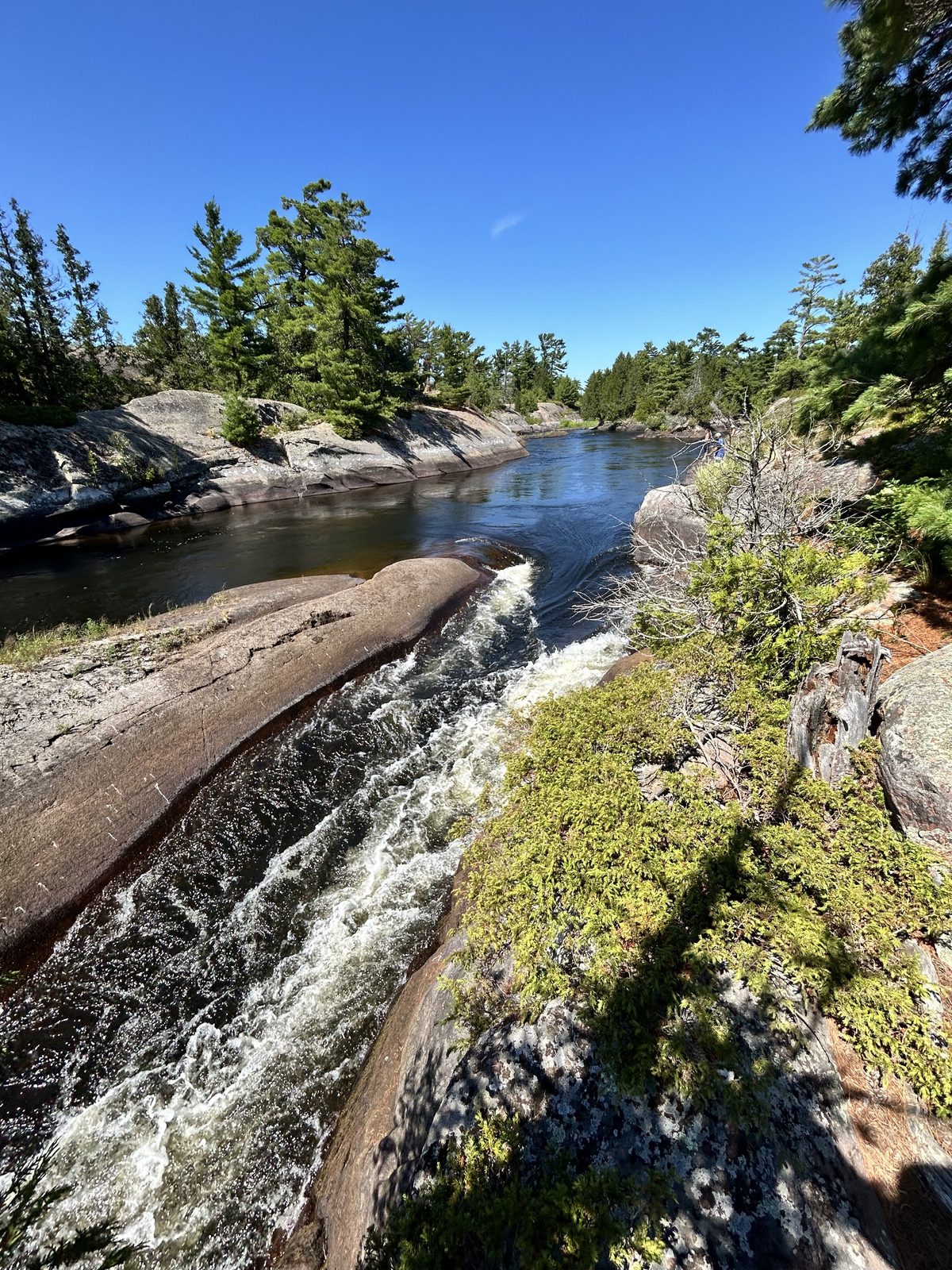
The Five Fingers are the delta's signature feature: the river splits into five channels dropping through granite. You do not need to run them. We had no whitewater experience, took the most eastern route, passed two swifts easily, and then climbed the short but steep 160 m portage around the Lily Chutes.
Two things made the decision easy. Water levels were high. And motorboats were running through the chutes — which is its own argument against being in a canoe there. Portages in the park are marked with yellow rectangular signs; find yours before you commit to a channel.
"Remote" here doesn't mean alone
Worth setting expectations. The delta is genuinely roadless and genuinely wild-feeling, and you will still share it. There are cottages. There are motorboats. There is a yacht anchorage within earshot of site 812. On the last day, traffic thickens as you approach Ox Bay and Hartley Bay, and not every boat slows for a canoe — watch for the wake they leave behind.
If solitude is the point of the trip, that's a booking decision, not a luck decision: pick 813 over 812, favour the channels over the bays, and plan the final approach to the marina for early morning.
Georgian Bay is a different body of water
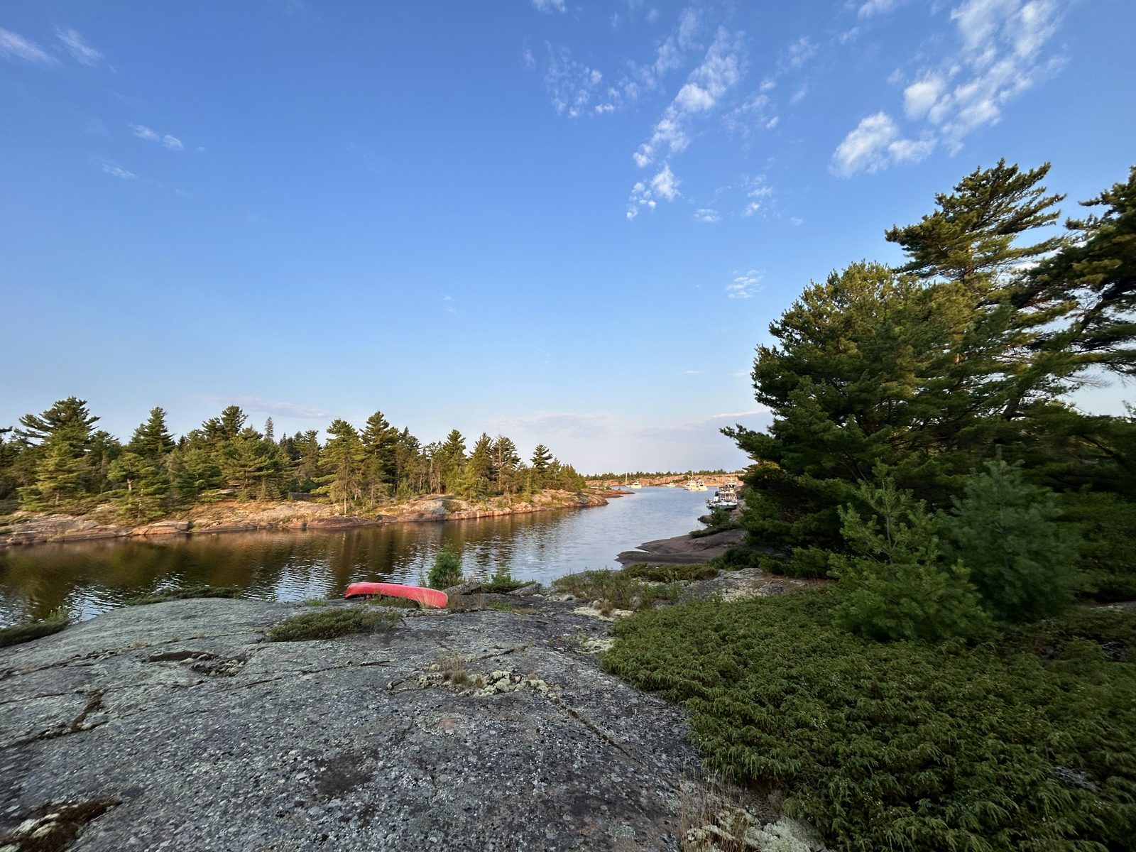
Day three and day four both touch the open bay, and the rule there is different from the rule on the river: go when it's calm, and be willing not to go. We left Sabine Island first thing in the morning, while the bay was calm, and covered the open stretch before the day had a chance to build. Wind and waves on a body of water that size turn a pleasant hour into a genuine problem, and there's no shoulder to pull over on.
The bear barrel changed the trip
Last year, on a different trip, a bear ate our food. This year we carried a 60-litre bear-proof barrel.
The obvious benefit is that the food survives. The one we didn't expect: the food survives intact. Everything that normally gets crushed into crumbs by day three — tea biscuits, chips, anything with structure — arrives at the last campsite in the same shape it left the car. A hard barrel isn't just bear protection, it's the difference between five days of trail rations and five days of actual meals. It's bulky in a canoe and worth every litre.
Booking, parking and getting on the water
Reservations. French River backcountry moved to a site-specific model — you reserve a specific numbered campsite for each night rather than a general zone, across roughly 291 backcountry sites, and the booking window opens five months ahead. We booked in March for August and had plenty of choice. That matches what we found in our long-weekend availability check: French River had 153 interior permits open for the Friday of the Civic Holiday weekend, four days out.
Access. Otter Bay is the only access point inside the park itself. Everything else is a private business with its own hours and fees, which catches people out — you can have a valid backcountry permit and still no legal way to leave your car. Ontario Parks is explicit that most boat access to the French River runs through private marinas and lodges, that launching fees apply, and that there is no river access from the Visitor Centre.
For this loop, Hartley Bay Marina is the one that matters. We parked there (paid) and rented our canoe there. Rentals are reservable in advance and worth reserving — it's a long drive to discover the boats are out.
Key River Marina, further south on Highway 69 about an hour below Sudbury, is the other end of the same country. Parking is a nominal fee and there's a canoe launch. From there the classic run is west down the Key River to its mouth on Georgian Bay, northwest along the coast, then north up the Pickerel River to Pickerel Marina — roughly 46 km over three days, with two portages totalling about 400 m (a 50 m carry around a small pond and a 350 m one beside a narrow channel, sometimes avoidable in high water). One honest warning: the Key River itself is a major powerboating channel and gets busy. Avoid it on weekends. The Pickerel stretch is the quiet, secluded half of that trip and the reason to do it.
The visitor centre. South of Sudbury just off Highway 69, with the "Voices of the River" exhibit on the region's nature and history, and the Recollet Falls Trail — a moderate 3 km return hike — from the same parking lot. It's a good hour before you get on the water, and worth it. Note that you cannot launch from there.
And afterwards. Ice cream at the Hungry Bear on the way back to the 400.
The neighbours: two other parks in the same corner
If you're driving four hours for this, it's worth knowing what else is within a short detour.
Grundy Lake Provincial Park sits just off Highway 522 at Britt, immediately east of the French River park. It is not a delta launch — it's the drive-in option next door: 488 campsites, 476 of them car camping, plus 10 backcountry paddle-in sites and a network of small inland lakes. Useful in two ways. It's a soft first or last night on either side of a delta trip, with taps and showers, and it's the fallback if the interior sites you wanted are gone. Same reservation system as French River.
Point Grondine Park is the one most paddlers have never heard of. It's 18,000 acres on the Georgian Bay coast between Killarney and French River, owned and operated by Wiikwemkoong Unceded Territory — not Ontario Parks, and booked through the community's own reservation system rather than the provincial one. The canoe access is a portage from the Highway 637 trailhead, about 38 km from the Highway 69 junction, into Mahzenazing Lake and roughly 20 km of interior routes across six lakes. Six portages, from 45 m to 1,200 m. There are 26 backcountry sites, plus a drive-in campground and an eco cabin, and the park runs Indigenous-guided experiences and cultural programming you won't find in a provincial park.
Two practical consequences of that separate ownership: Point Grondine availability doesn't show up in an Ontario Parks search, so a park that is genuinely open can look like it doesn't exist — and if the French River interior is booked for your dates, it's the nearest alternative almost nobody thinks to check.
How we know all this
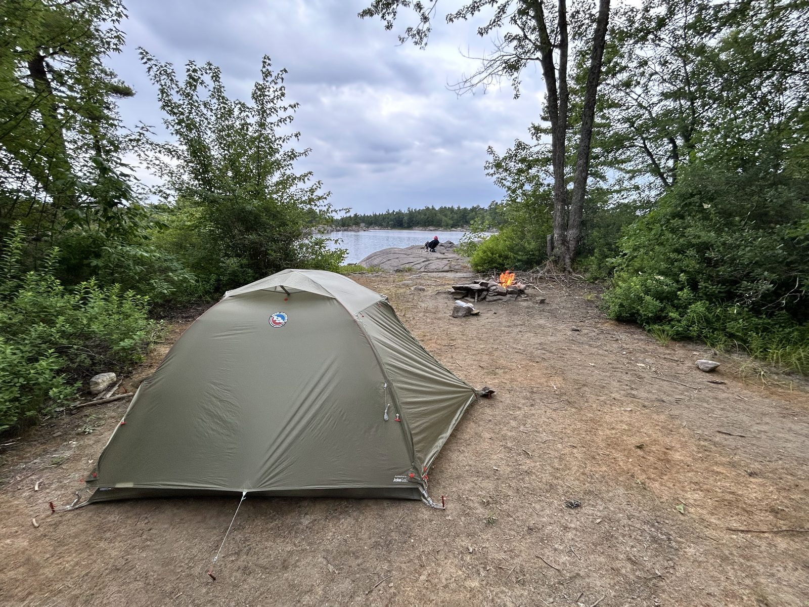
Campaid is a booking assistant for Canadian camping trips — it checks live availability across Ontario Parks, Parks Canada, Sépaq and more, per night rather than as a single sold-out yes/no, and factors in what the booking page never tells you: fire bans, road and rail noise, how exposed a site is, drive time from where you actually live. Backcountry sites are the hardest case, because the thing that makes or breaks a night — a yacht anchorage in the next bay, a bear-activity sign, whether the tent pad is flat — isn't in any database. So we go and look, and we write it down.
If you've paddled the delta and disagree with any of these site calls, tell us. Backcountry site notes get better the more people contribute them.
Frequently asked questions
How long does the French River Delta loop take?
Five days at a relaxed pace — our tracks measured 55.1 km split into legs of 7.4 to 14.3 km, which puts you at camp by mid-afternoon each day. The same loop is commonly listed as a 3–5 day trip, so it compresses to four or even three days if you want longer paddling days.
Do I need whitewater experience for the Five Finger Rapids?
No. Take the most eastern channel: two easy swifts, then a steep 160 m portage around the Lily Chutes. We did it with no whitewater experience at all. Motorboats also use the chutes, which is a further reason not to run them in a canoe.
How far ahead do I need to book French River backcountry sites?
The window opens five months out and you reserve a specific numbered site for each night. Booking in March for early August left us plenty of choice — this isn't Algonquin's Highway 60 corridor. Long weekends are tighter but far from full.
Where do I launch for the delta?
Hartley Bay Marina is the usual put-in for the West Channel loop, with paid parking and canoe rentals on site. Key River Marina, further south on Highway 69, is the other common launch and opens a different 46 km route via Georgian Bay and the Pickerel River. Otter Bay is the only access point inside the park boundary; every other entry is through a private marina or lodge with its own fees and hours, and there is no launching from the Visitor Centre.
What if French River is fully booked for my dates?
Two neighbours worth checking. Grundy Lake Provincial Park, just off Highway 522, has 488 sites including 10 backcountry paddle-in ones and books through the same Ontario Parks system. Point Grondine Park — 26 backcountry sites on the Georgian Bay coast between Killarney and French River — is owned and operated by Wiikwemkoong Unceded Territory and books through its own system, so its availability never appears in an Ontario Parks search no matter how open it is.
Is the French River Delta a good beginner canoe trip?
It's a good second trip. The paddling is easy and the portages are few and short, but the sites are basic granite with no facilities, cell service is unreliable, Georgian Bay can turn dangerous in wind, and you need proper food storage. Come self-sufficient, and bring a paper map — the West French River sheet from Maps by Jeff covers this loop.
Do I need a bear barrel?
You need something bear-proof. We lost our food to a bear the previous year and carried a 60 L hard barrel this time. It also keeps the food intact, which turns out to matter more than you'd think.
Planning a trip like this? Campaid checks live availability across Ontario Parks, Parks Canada, Sépaq and more — per night, with cancellations, noise, privacy and fire bans factored in. Try it free.